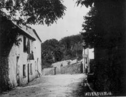
Heversham
and Leasgill are now in the county of Cumbria but prior to the reorganisation of
local government in 1974, they were located in Westmorland,
described in 1828 by Pigot and Co as follows–
‘
… an inland county, being bounded on the
north
and north-west by Cumberland, on the east by Durham and Yorkshire, and on the
south and south-west by Lancashire. 'Westmoreland' received its name from its
situation to the west, and the principal part of it being formerly moorish
barren land. It is one of those counties which, in the time of the Romans, was
inhabited by that tribe of the ancient Britons called the 'Brigantes.' Under the
Saxons it formed part of the Kingdom of Northumberland. Traces of two Roman
roads are still visible, one from Carlisle to Appleby, and the other from the
Picts wall in Cumberland, by Kendal, to Lancaster.
The
county is divided into two unequal portions, called the baronies of Westmoreland
and Kendal; the former although abounding with hills is comparatively an open
country; the latter is very mountainous containing many bleak and barren hills,
usually called the fells. The western mountains contain mines of copper and in
some places have been discovered veins of gold. Slate and limestone quarries are
productive and near to Kendal, a beautiful and variegated marble is found which
is worked into chimney-pieces, ornaments etc.
The
county lies in the province of York and the diocese of Carlisle. It is divided
into four wards, East, West, Kendal and Lonsdale. There is one borough and
county town (Appleby) seven other market towns, and thirty-two parishes.
Westmoreland's
lakes are Winander-Mere and Ulleswater. The former is the largest in England,
and is situated partly in Cumberland.’
Probably
around 1900, Westmorland was described as follows -
‘Westmorland, a county
in N. of England; bounded NW. and N. by
Cumberland, NE. by Durham, E. by Yorkshire, and S. and SW. by Lancashire and
Morecambe Bay; greatest length, N. and S., 32 miles;. greatest breadth, E. and
W., 40 miles; area, 500,906 acres, population 64,191. Westmorland presents
continuous succession of mountain, moor, and fell, intersected by deep winding
vales, traversed by numerous streams. The principal of these are the Eden,
Lowther, Lune, and Kent, the last forming the broad estuary which terminates in
Morecambe Bay. The mountains consist of various ridges belonging to the Pennine
and Cumbrian chains. Helvellyn, on the Cumberland border, rises to a height of
3115 ft. The western part of the county is within the Lake District, and
contains Hawes Water, Grasmere, Rydal Water, and Ullswater on the Cumberland
border, and Windermere on the Lancashire border. The climate is moist. The
arable land is mostly confined to the valleys, where the soil usually consists
of a dry gravelly loam, well adapted for turnips, but the greater part of the
county is natural pasture. A few tracts of woodland remain of the forests which
formerly clothed all the hills. The mineral productions include graphite,
marble, roofing slate, and some coal, lead, and copper. The only manufactures of
any consequence are the coarse woollens of Kendal. The county has good
communications by railway.’
Further back in time, the area
around Heversham and Leasgill marks the Southern extremity of the ice covering
some 10,000 years ago. Many drumlins were deposited on the limestone bedrock
during the last Ice Age. More dramatic effects of the ice can be seen not far
away in the Lake District and the sculptured outlines of the Coniston, Langdale
and Fairfield ranges are all visible. More obvious in all weathers is the
limestone escarpment of Whitbarrow Scar just to the North-West across the River
Kent. To the West is the drained and fertile plain of Milnthorpe Marsh and then
the open expanses of sand and mud that provide the estuary for both the Kent and
the Bela as the water makes its way to Sandside, Arnside and finally to
Morecambe Bay. Heversham and Leasgill are positioned between the boulder-clay
drumlin known as ‘Haysteads’ to the West and the exposed carboniferous
limestone of Heversham Head to the East. These limestone outcrops are scattered
around the area and also include Farleton Fell and Arnside Knott.
As for distant social history; the Celts, the Romans, the
Vikings and then the missionaries from Ireland would all have passed this way
between 2,000 BC and 400 AD. Further advances by the Vikings occurred up to
around 900 AD. More detail on all historical aspects of the vicinity,
particularly on Milnthorpe and Heversham, can be found in recognised and
accessible sources.
Jumping to the year 2001, Heversham and Leasgill and this area of South Lakeland are situated in present-day county of Cumbria. In 1974, Westmorland was incorporated into Cumbria together with Cumberland, the Furness part of Lancashire and a small part of the former West Riding of Yorkshire around Sedbergh. Some four miles to the North is Kendal. Less than a mile to the South of Heversham is the village, or ‘town’ of Milnthorpe and two miles beyond Milnthorpe is the county boundary with Lancashire.
Pigot and Co. (1828) National Commercial Directory